
A Colgate computer science professor’s research is included in a new exhibition at the Smithsonian National Museum of Natural History.
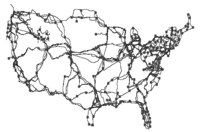
Tracing America’s physical internet infrastructure through major cities reveals a pattern that follows roads, rail lines, and pipelines. It uncovers the paths of fiber-optic cables, which connect internet signals between major cities. This figure originally appeared in the research article “InterTubes: A Study of the U.S. Long-haul Fiber-optic Infrastructure,” which was co-authored by Professor of Computer Science Joel Sommers. It is now featured in the Smithsonian National Museum of Natural History’s exhibition titled Cellphone: Unseen Connections. Sommers’ research maps the long-haul fiber-optic network in the U.S. using data both from major cable and internet service providers and local municipalities to chart how the physical conduits of optical fiber are shared among providers. Further, his research article assesses the implications of the map regarding performance, net neutrality, and policy decision making. Alongside Sommers’ image of the internet’s physical route, the Smithsonian exhibition features objects such as the first commercial cell phone and a display showcasing a few elements and minerals — copper, gold, and lithium — that power our mobile devices. All aspects of the exhibition point to one claim: man-made cell phones and their associated infrastructure bring us closer to one another.
Editor’s note: The map’s visual presentation is intentionally blurred due to security reasons.