
To understand the interaction between the climate, hydrology, and the Colgate community, a newly installed natural laboratory is now collecting data through specialized monitoring stations on campus and in a local creek. Assistant Professor of Earth and Environmental Geosciences Joe Levy, Professor of Geography Adam Burnett, and students installed the custom climate monitoring stations.
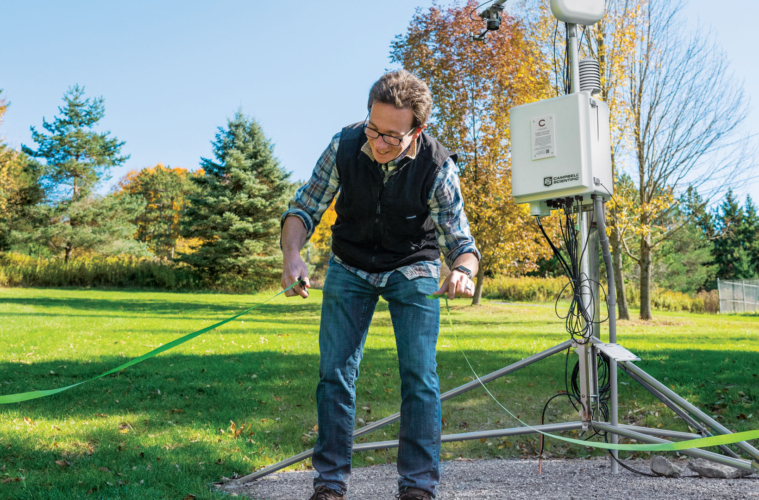
The largest, with the most numerous systems for measuring various climate processes, is located at Colgate’s Harry H. Lang Cross Country and Fitness Trail. “It has sensors to measure energy balance — both ultraviolet and infrared rays, and photosynthetically active radiation — temperature, humidity, wind speed and direction, precipitation, and snow depth,” Levy says of the station situated near the trails behind Chapel House above Colgate’s campus. “And there are even cameras for phenology, so we can capture the timing of when leaves fall and return each year.”
The locations were chosen so we can get a full picture of the watershed…
Assistant Professor of Earth and Environmental Geosciences Joe Levy
Two smaller weather stations have been placed to better understand campus microclimates — one in the forest above campus and the other in the village center atop the Colgate Bookstore. While the weather stations measure rainfall and snow, special instruments have been placed in Payne Creek to monitor the change in water level, water temperature, and salinity in order to help determine flooding risk. Groundwater and soil moisture sensors are scheduled for deployment in the spring.
The Colgate University Climate Network was created to help researchers better understand the nuances of the local climate on campus and how things like snowfall, rainfall, wind, humidity, and sunshine affect various ecosystems, ranging from the top of Colgate’s old ski slope down to the bottom of the hill, where Payne Creek feeds into Taylor Lake and ultimately into the Chenango River. The northeast United States is forecast to become rainier and stormier in future years, putting pressure on communities adjacent to rivers and lakes.
“We can access that data from the cloud, and then we can monitor data that are updated every hour,” explains Izzy King ’23, a geology major from Wilton, Conn. “The locations were chosen so we can get a full picture of the watershed, from high elevation to low.”
Levy says it will take some time before the data become useful for campus and village planners seeking to understand how the area’s watershed impacts drainage near Taylor Lake and Payne Creek — mostly because this is the first time that Colgate will have regular monitoring of important data points related to climate change and our place in it.
“We don’t really have a sense of what is normal in a year,” Levy said. “Once we have a few years of data, we’ll be able to compare those statistics with other data that have been collected in the region, and then we’ll have a better handle on what might be coming down the pike.”
The equipment, which cost about $60,000, was funded by the Colgate Picker Interdisciplinary Science Institute, the Geology Boyce Fund, and the Department of Earth and Environmental Geosciences.