

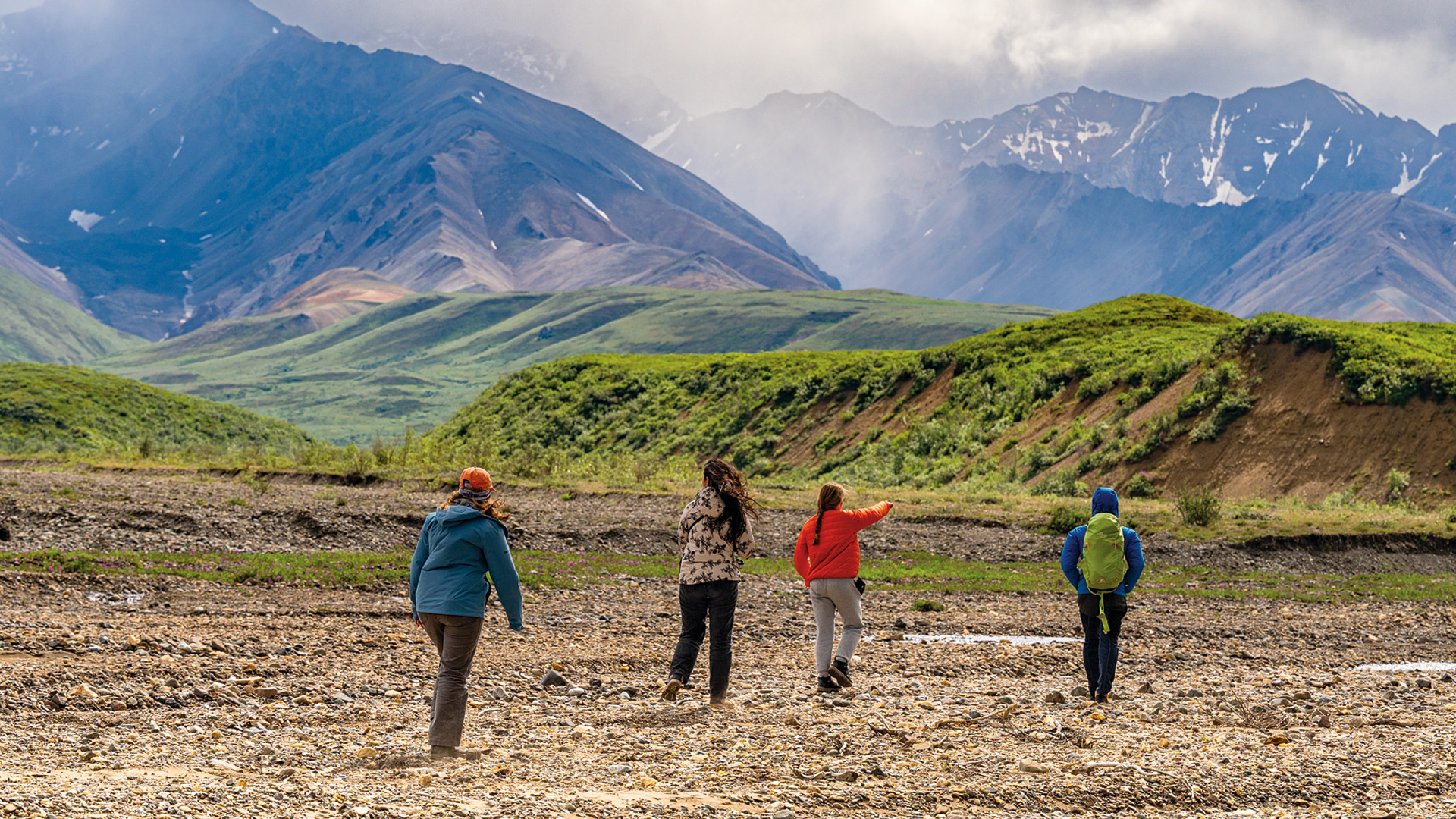
More than 200 miles from Fairbanks, Alaska, Tangle Lakes form the headwaters of the Delta River. A freezing wind blew across the water, shuddering the tent flaps as the research team scrambled to set up camp and secure anything that could blow away. They were lucky to get a spot for their three tents in the small campground in July, already filled with campers fishing for lake trout and Arctic grayling. Their tents pitched, they climbed to a nearby hilltop for some late-afternoon data collection.
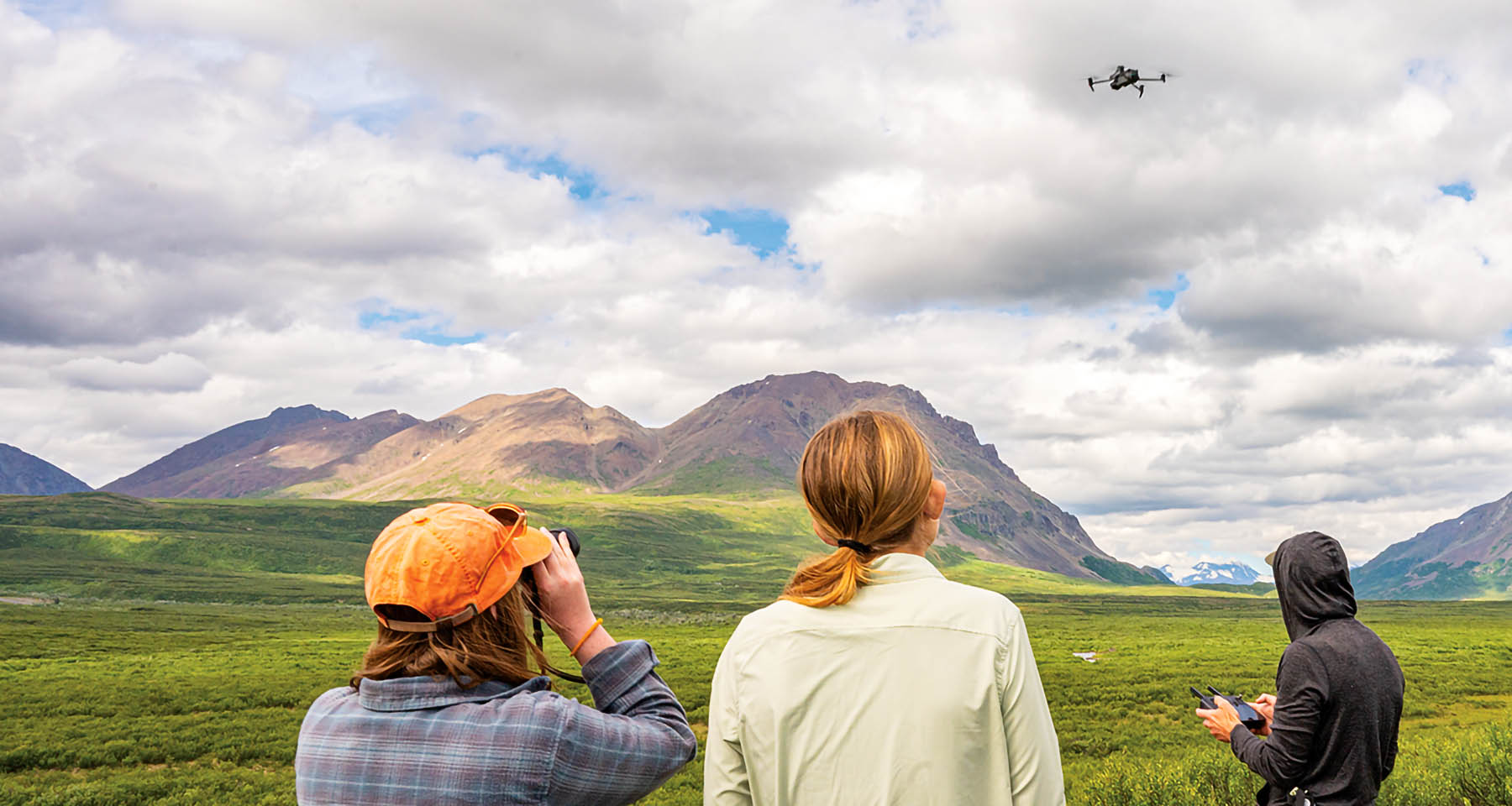
Half an hour later, anyone stumbling across them would have found an odd scene — four people huddled in a patch of bushes, staring intently into the distance, seemingly looking at nothing. “Can anyone see it?” Professor Mike Loranty asked. “I do,” confirmed Katrina Wright ’26, gesturing toward a distant mountain peak. Collectively, they scrunched their noses and squinted in the direction she pointed, eventually picking out the tiny black drone moving left to right against the greens and browns of mountain vegetation. Federal law requires the operator to be able to see the drone with the naked eye, and they could always rely on Wright to spot it.
“Some of the changes that people have been hypothesizing are actually happening on the landscape,” he said. “Things like more intense wildfire seasons and permafrost thaw — those are the two big ones, and you’re really starting to see those things.
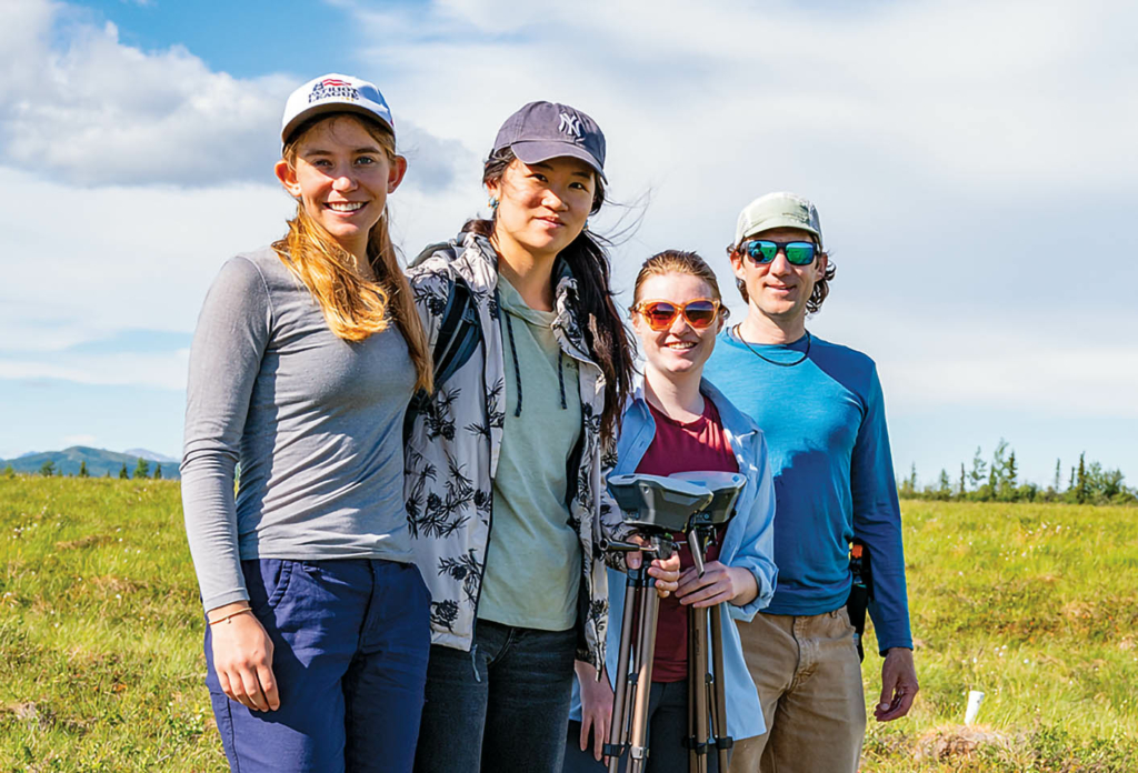
Elaine Zhou ’25, Katrina Wright ’26,
and Prof. Mike Loranty
Aside from Wright, Elaine Zhou ’25 and Maddox Miller ’27 rounded out the team of students alongside Loranty, professor of geography and director of the Environmental Studies Program. Loranty is no stranger to working with drones and looked at home on the tundra. The students, meanwhile, brought varying degrees of experience with the outdoors and no experience with fieldwork like this.
Loranty studies how climate, vegetation, permafrost, carbon cycling, and wildfires interact in arctic regions worldwide. Climbing temperatures trigger changes in these systems, and understanding the scope of these changes means looking at all the ecosystem’s components. The vegetation growing on top of permafrost changes as the permafrost thaws. The hydrogeology of the area shifts. And the animals that live on the landscape and their interactions with food and water sources all change. Loranty captures these variations through his work, with numerous projects funded by NASA and the National Science Foundation.
Some of the changes that people have been hypothesizing are actually happening on the landscape,” he said. “Things like more intense wildfire seasons and permafrost thaw — those are the two big ones, and you’re really starting to see those things
“Especially permafrost thaw,” he added, “it’s kind of a bellwether of change.”
Loranty uses remote sensing and several other fieldwork techniques to sample vegetation and soil, as well as measure various aspects of permafrost.
“In a lot of environmental fields, and especially working in physical geography, you rely on GIS and remote sensing,” he said. “The pace of change in analytical and computational capabilities, like the types of data we can acquire, almost requires you to continually learn new skills, and if you don’t, it’s harder to work on the cutting edge.”
New directions and projects are commonplace for Loranty these days. Aside from occasional trips to Alaska, for about 10 years, his primary field site was in Siberia. Then COVID-19 hit and, soon after, the war in Ukraine, forcing Loranty’s focus back to Alaska. But the shift opened doors to new projects that brought him and the students to the field last July. This time, his team laid the groundwork for two new studies involving high-resolution imaging, one of vegetation on the tundra and the other looking for beaver dams.
When they weren’t camping, they crammed into a dorm at the University of Alaska Fairbanks (UAF). They cooked, ate, and spent evenings together, discussing the next day’s plans. In midsummer that far north, the sky never fully darkens, and long after saying goodnight, the students could be heard chatting and laughing in their room. Mornings were chaotic. Everyone rushed to make coffee and tea, turned leftovers into breakfast foods, and smeared peanut butter and jelly onto slices of bread for lunch before climbing into the truck with water bottles, hiking boots, backpacks, and gear for the day.
They focused primarily on field sites near Eight Mile Lake, two hours south of Fairbanks, down the Parks Highway. The paved road turns into gravel and gets progressively narrower, rockier, bumpier, and then impassable as you approach Eight Mile Lake. This part of Alaska is infamous as the setting for Christopher McCandless’ ill-fated ventures in the 1990s, popularized by Into the Wild. It’s also a favored area for researchers, and evidence of ongoing experiments is scattered across the upland tundra.
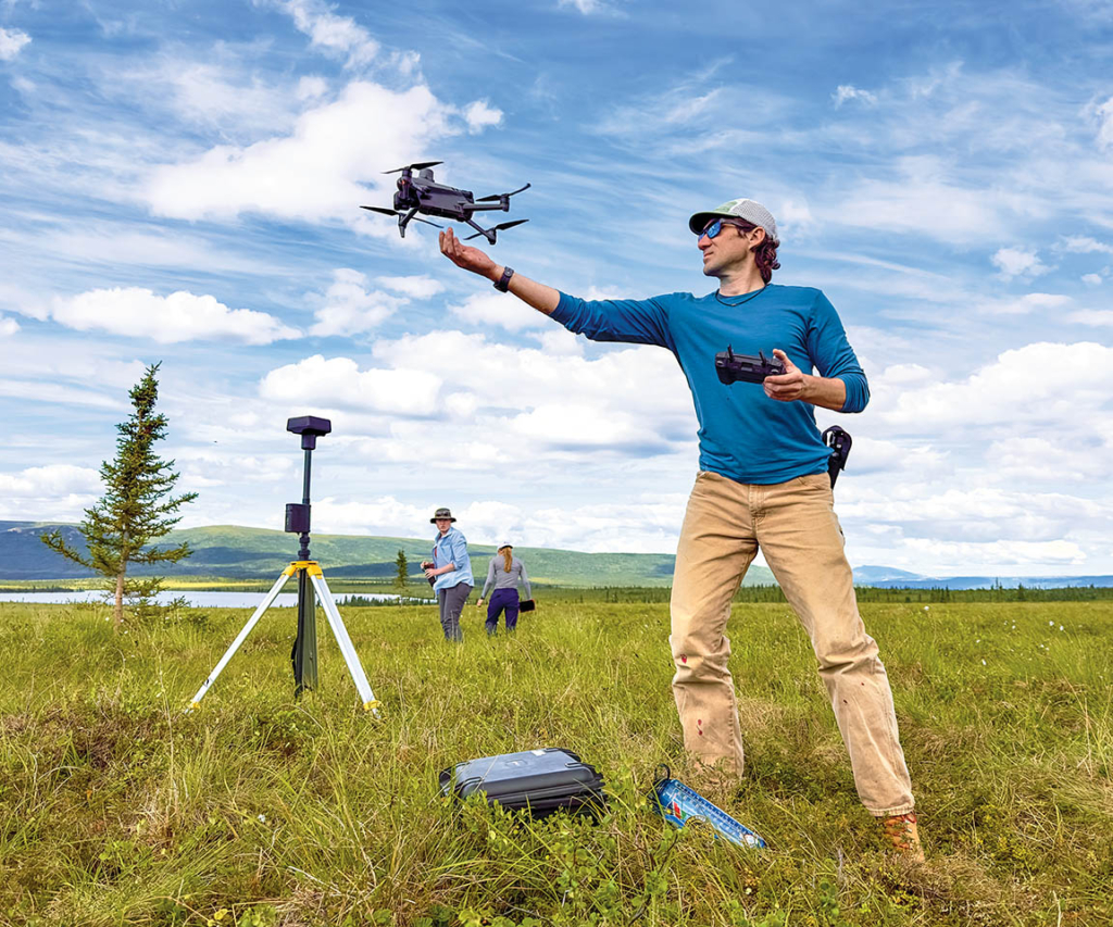
Loranty wants to use high-resolution drone imagery to train AI algorithms to detect landscape and vegetation characteristics. Drones have gained traction as a remote sensing tool since the early 2000s because they offer a cost-effective, flexible alternative to satellite or aerial surveys. They are particularly valuable in hard-to-reach or hazardous environments and can cover much more ground than a team of researchers on foot. The drone Loranty uses has five separate cameras. The “normal” camera sees what we do, while the other four capture narrower segments of the electromagnetic spectrum, providing information about greenery, photosynthesis, plant health, and water content. Loranty programs the drone’s flight paths anywhere from 100 to 400 feet high, and each camera takes a photo every few feet — on some flights, they collect upward of 20,000 images. It can take a computer 24 hours to stitch them all together, resulting in an incredibly detailed map that the research group will use to identify different types of vegetation and, if the AI training works, one of the hallmark features of the North American and Eurasian Arctic, the tussock.
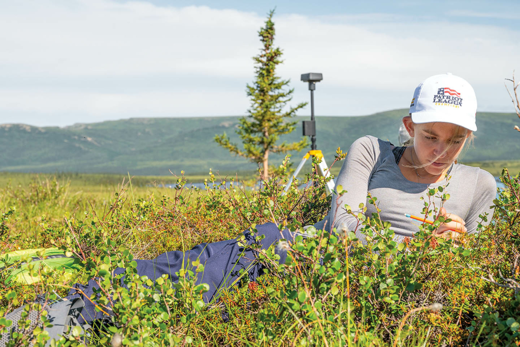
“Tussocks,” said Loranty, pointing to the one he was sitting on, “are funky pineapple-like growths associated with sedges (a grass-like plant) called cotton grass.” The stems and leaves of tussock grasses cluster at the base, creating a dense mound of vegetation with a tuft of grass sprouting from the top. Each tussock is around a foot in diameter and the same height. The dense base traps moisture to form a microclimate that protects the plant from the frost and wind of Arctic winters. Loranty’s interest in tussocks started when he collaborated with Sal Curasi ’15 during Curasi’s PhD work. Curasi, now a research scientist at the Canadian Centre for Climate Modeling and Analysis, also worked with Loranty in Siberia. Now Loranty has returned to Alaska to see if he can map tussocks on a bigger scale.
“It’ll be interesting to see if we can train a computer to recognize these things because they store carbon and have not typically been included in carbon accounting in these ecosystems.” Loranty points out it’s a nontrivial amount of carbon missing when tussocks are overlooked, so accounting for it will give more accurate models of how much carbon is stored in these systems and, therefore, how much could be released if the environment changes.
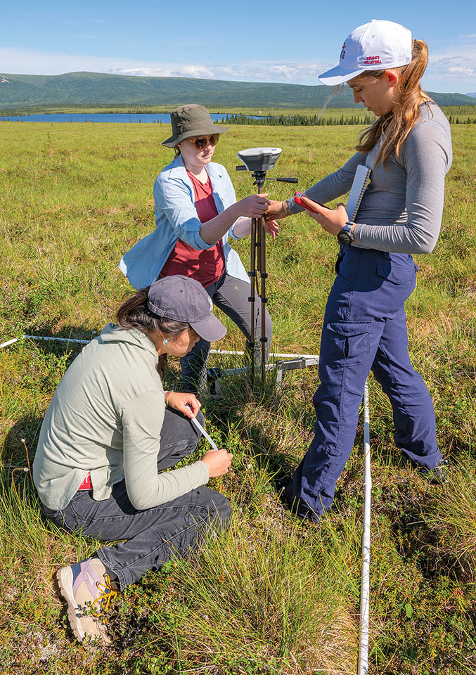
He gestured at the students, lugging the instruments needed to measure tussocks by hand — a floppy 2-meter square grid, measuring tape, and a large set of calipers — across the tundra. Rather than focusing on tiny, spatially distributed plots, drones measure the entire landscape, and it would be game-changing if they could use these imaging techniques to answer questions that ordinarily require hundreds of hours of fieldwork. “We’re still out in the field,” Loranty pointed out, “but rather than taking lots and lots of field measurements, we’re flying a drone, which we can do in 20 minutes or an hour, and then couple that with some minimal field measurements to answer questions that way.”
In addition to the tussocks, they drove hundreds of miles around Fairbanks to fly the drone over wetlands with beaver dams. The north’s expanding beaver population has garnered much attention in the past several years, but their presence’s long-term effects are unknown. When beavers build dams, they alter waterways, potentially impacting the permafrost, vegetation, or the landscape’s resilience to wildfires.
“We’ve already seen examples of beavers building dams and forming big ponds, and then it thaws a bunch of permafrost,” Loranty said. When dams fail, water flows over the landscape, causing subsidence (when the ground sinks or caves in) and potentially further thawing the permafrost.
“When it happens in one spot, it might be relatively small in the context of the Arctic,” he said, “but if you start having that happen all over the place because of beaver dams, it affects hydrology, fisheries, and people who live in these areas or depend on fish for subsistence livelihoods. So that’s part of the motivation for the work.
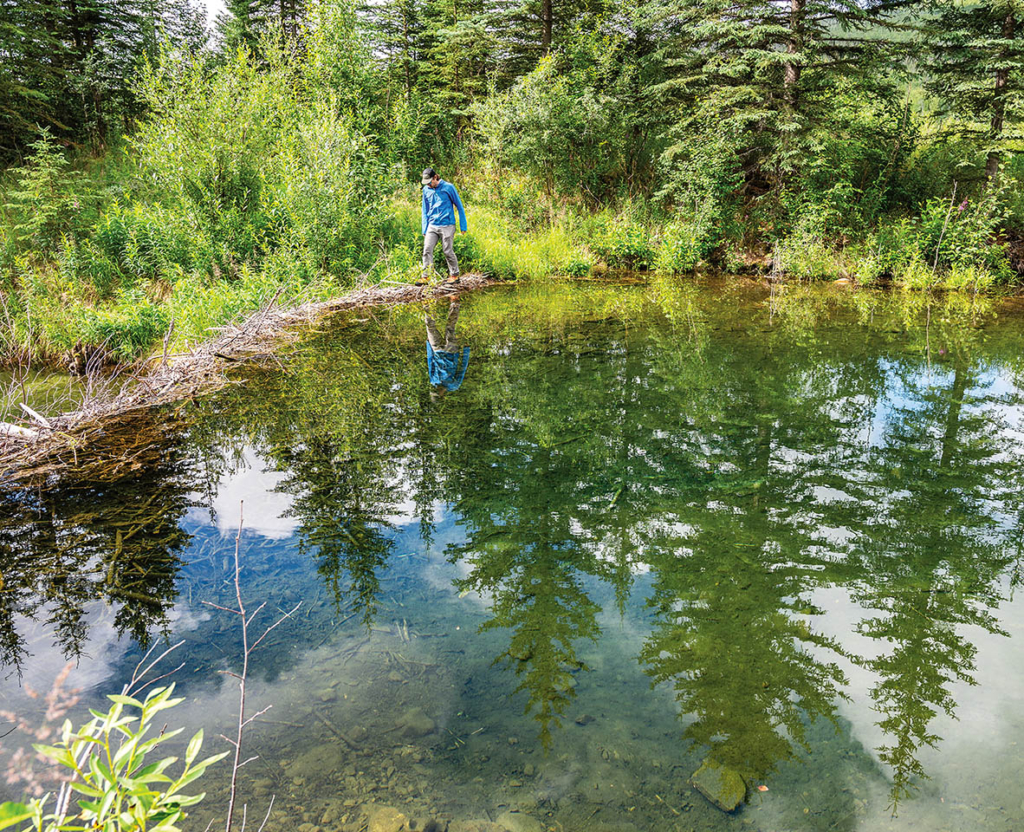
“Beavers are a new thing for me topically,” Loranty said. “I’m used to thinking about vegetation, and now you’re throwing animals into the mix. It’s a different sort of ecology,” he said. “But it’s kind of refreshing to think about new things and places I’m familiar with from a different perspective.”
Before leaving for Alaska, the students worked with Loranty to develop individual questions they could tackle — critical first steps for a new project and the students.
As the drone buzzed overhead one afternoon, everyone sat among the cotton grass, chatting about their projects and picking tiny blueberries and sunset-colored cloudberries at their feet.
“We’re doing the tussock part here, and then the other part is our personal projects about beavers,” said Zhou, “and so we’re out doing fieldwork, which is challenging, but then we’re also thinking through the data and analysis when we’re not in the field.” For her project, she looked at segments of waterways impacted by wildfires and compared streams with beaver dams to those without to see if there was any difference in fire damage. Miller looked at the number of beaver dams before and after fires. Finally, Wright was trying to determine how confident we can be that different people analyzing maps to locate beaver dams are getting matching data.
In July, new to fieldwork and their projects, the students knew technically what they were studying but were unsure how to proceed. They asked questions and grappled with the idea that there wasn’t always a tidy answer. A turning point was meeting other students and researchers in the field and realizing that collaboration is everything in science.
They spent a day measuring tussocks with one of Loranty’s colleagues from Hamilton College, Heather Kropp, and three of her students. A few days later, they were almost giddy at meeting another collaborator, Ken Tape, an ecology professor and beaver specialist at UAF, whose name they knew only from the journal articles they’d read for their projects.
Every drone flight, every tussock measured, and every beaver dam they map is an opportunity to learn something new.
“It’s been so great meeting other professors,” Wright said. “You hear them talking through their work and see what being a researcher is like. This has been one of the biggest learning opportunities I’ve had in my life.
“In college,” she added, “it feels like there’s a right answer for tests or essays, but then you get out into the field, and it’s this whole different world, and it’s so much cooler!”
Zhou had the least outdoor experience on the team but brought her theoretical knowledge from her geography and biology double major. “This is such a good experience,” she said, “because now I am actually doing fieldwork, and I kind of know what the research process looks like, so it’s not just the words coming out of my mouth, but it’s actually what I’m doing, and doing is the key part.”
Loranty echoed this. “Seeing the place you’re studying is pretty important,” he said. “You can read and learn about things, but there’s no substitute for seeing a system, being in a place, being removed from distractions so you can take the time to observe, think, and ask questions.”
While science is the primary goal, the value for the students is so much more. “Everything we did was either beaver research or tussock research,” said Miller, “but we also did get to see amazing parts of Alaska, like Denali.” In fact, they encountered most of Alaska’s iconic megafauna. They saw a red fox snatch a ptarmigan out of midair, bald eagles, Dall sheep, and a grizzly bear. A moose wandered through one of the sites as they flew the drone, and the grand finale was finding a giant herd of caribou scattered across a rocky, windswept mountainside. But after driving hundreds of miles, seeing countless ponds with beaver lodges, walking across dams, taking photos, discussing projects, and meeting beaver researchers, that’s one animal they never managed to find.
Zhou and Wright continued their projects into the fall. They sat in a lab meeting with Loranty and showed off drafts of posters they’d prepared for the annual American Geophysical Union conference in Washington, D.C., in December. They’d had time to piece together the maps they’d collected and familiarize themselves with their data. And they had interesting findings to report.
Zhou found that beaver wetlands are no more fire-resistant than valley bottoms, directly contrasting findings on beaver activity in the western U.S. This suggests that the impact beavers have on different landscapes isn’t uniform and reinforces the need for more work in the Arctic to understand the dynamics between beavers and wildfires better. Wright found significant uncertainty and disagreement when different researchers tried to identify beaver dams on maps — important information as these datasets are used to drive AI models to automate dam detection.
Every drone flight, every tussock measured, and every beaver dam they map is an opportunity to learn something new. Zhou and Wright debated the next steps for their projects with Loranty, deliberating on how best to analyze their data. They were thousands of miles from the vast mountain landscapes and the tundra that inspired their work, but that wasn’t the biggest difference. Something had changed, and it took a while to pinpoint what it was. Suddenly, it was clear. Back in the summer, they’d sounded like students. Now, they sounded like scientists.